In order to keep up with technological advances in mapping and to meet the demands of trail users who have been requesting a navigational smartphone application, the Foothills Trail Conservancy (FTC) teamed up with FarOut (formerly Atlas Guides Guthook) to produce this navigational app. It is undoubtedly the most comprehensive digital navigational resource we have ever developed and is available now through iTunes and the Google Play Store. Just search for “FarOut.”
The app includes just about everything a trail user would ever want to know, and if you’re concerned about what happens when you don’t have a cell phone signal, no worries! One of the greatest features of the app is that no mobile or internet service is required to use it, after the initial setup.
If you have any issues downloading or activating a subscription, please contact [email protected] for assistance.
Some of its features include:
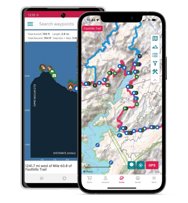
GPS-enabled map of the Foothills Trail with waypoints
Offline topo maps, satellite imagery, and photographs
Detail page for each waypoint
Elevation profile with waypoints
GPS-enabled data book listing of all waypoints
Comprehensive water information
Complete gateway community and resupply information
Trailhead information
Text or email your location
Note: When you buy the Foothills Trail App or use our affiliate links to buy any FarOut products, a portion of the purchase goes to support the Foothills Trail.