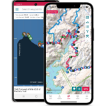
Maps & Coordinates
Please note that while the Foothills Trail Conference has endeavored to make all maps and trail descriptions as accurate and reliable as possible, they should be considered informational only. Information regarding the degree of difficulty of trails is general and subjective.
GPS Coordinates
|
Oconee St Park Access
|
34 51.807
|
83 05.880
|
|
Jumping Branch Access ( SC 107 )
|
34 54.197
|
83 06.414
|
|
Cheohee Rd Access (SC 107)
|
34 54.946
|
83 06.714
|
|
Nicholson Ford Access
|
34 55.499
|
83 07.338
|
|
Burrell’s Ford Access
|
34 58.261
|
83 06.894
|
|
Fish Hatchery Rd Access
|
34 58.619
|
83 04.410
|
|
Sloan Bridge Access
|
35 00.198
|
83 03.246
|
|
Whitewater Rd Access (NC281)
|
35 01.538
|
83 01.068
|
|
Whitewater Falls Parking Lot Access
|
35 01.746
|
83 00.957
|
|
Bad Creek Access
|
35 00.736
|
82 59.940
|
| Canebrake Boat Access |
35 03.923
|
82 53.430
|
|
Laurel Fork Boat Acess
|
35 01.934
|
82 53.808
|
|
Laurel Valley Access
|
35 02.938
|
82 48.828
|
|
Chimneytop Gap Access
|
35 03.792
|
82 47.916
|
|
Sassafras Mt Access
|
35 03.870
|
82 46.620
|
|
Table Rock Access
|
35 01.923
|
82 42.024
|
|
Caesar’s Head St Park Access
|
35 06.956
|
82 38.304
|

